
Western U.S. Wildfires Hit Peak Alert — What Nomads Should Know
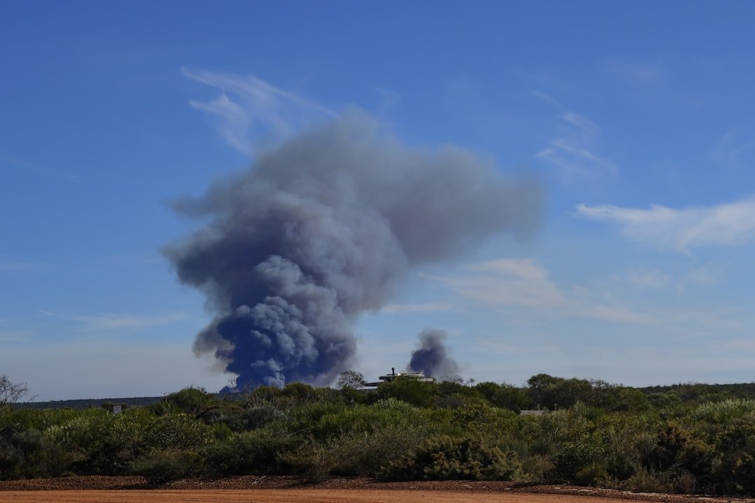
The U.S. wildfire system has been locked at National Preparedness Level 5 — the highest tier on a five-point scale — since federal officials raised it on July 18, and the pressure has not let up. As of July 25, more than 88 large fires were burning simultaneously across the country. The National Interagency Fire Center, based in Boise, Idaho, reported that more than 4 million acres had burned nationwide through that date, with 21 new large incidents added in a single day and more than 23,000 firefighters and support personnel engaged in suppression operations.
The Northwest Geographic Area, which covers Oregon and Washington, was the only region classified at the full PL 5 status. States explicitly flagged in federal fire activity reports include Oregon, Idaho, Utah, Colorado, Minnesota, and California — together accounting for the bulk of the season's most intense burning.
What PL 5 actually means on the ground
A National Preparedness Level 5 designation, according to NIFC reporting carried by NPR, means all available national fire resources are deployed. There is no domestic reserve to send to new ignitions. Federal fire managers requested international assistance, with an elite crew from Australia expected to arrive in the West that weekend. The concern: simultaneous severe fire seasons in parts of southern Europe have placed competing pressure on those same international resource pools.
For anyone on the ground in fire country, the most immediate consequence isn't flames — it's smoke. Oregon communities had been enduring poor air quality for weeks by the time the PL 5 was declared, with residents in eastern Oregon and other fire-adjacent zones describing prolonged periods in which outdoor activity was unsafe. Wildfire smoke carries fine particulate matter (PM2.5) that poses risks across all age groups, and the EPA's AirNow Fire and Smoke Map provides real-time readings by location.
What this means for remote workers and nomads
If you have summer plans in the West — whether that's a national park road trip, a co-working stint in a mountain town, or a cross-country drive — PL 5 is the signal to check conditions actively, not assume them. Resources for the season are exhausted. That means road and recreation-area closures can expand with less advance notice than in lighter fire years, and local emergency infrastructure is strained.
The practical starting point is the AirNow Fire and Smoke Map, which updates in near-real time and lets you check any destination before you commit to travel or step outside to work from a deck or patio. If your destination sits under an Air Quality Index reading of 151 or higher (the "Unhealthy" band), outdoor coworking spaces and open-window ventilation become genuine health hazards — not inconveniences.
Remote work flexibility is genuinely useful here. Unlike office commuters locked to a single geography, nomads can shift eastward or to urban cores with better air filtration infrastructure. If you are locked into a Western destination, verify your travel insurance covers wildfire-related trip interruptions — many policies exclude wildfires by name or classify them as foreseeable events once a PL 5 is in effect. Checking that exclusion language now, before a forced cancellation, matters.
The season is not over. The current 4 million-plus acres burned still falls short of the more than 10 million acres recorded in 2020, but federal managers warn that fire behavior at PL 5 with depleted crews is the exact scenario where a single wind-driven ignition can escalate rapidly. Staying informed is the lightest and most effective thing a traveler can do.
Sources
Wildfire alert in the Western U.S. reaches its highest level — Wyoming Public Media / NPR, July 25, 2026
National Fire News — National Interagency Fire Center, accessed July 26, 2026
National Interagency Coordination Center — National Interagency Fire Center, accessed July 26, 2026
Wildfires — Fire and Smoke Map — AirNow / EPA, accessed July 26, 2026
You Might Also Like
Travel + Remote Work Briefing — October 15, 2026

Travel + Remote Work Briefing — October 14, 2026
Travel + Remote Work Briefing — October 13, 2026